Summary: 450km in 13 paddling days plus 3 non-paddling days plus 3 additional days commuting = 19 days door to door.
Highlights:
- Getting to the start. I’ve been planning and dreaming of this trip for a while. Its been a long time coming
- The team – I was lucky enough to have a great team (Richard, Gary andMardi) and we all looked out for each other, shared cooking duties and got on well
- Wright Rock – seeing all of the seals lifted us for the rest of the big crossing
- Bumping into all of the other sea kayakers – hearing their stories and meeting them was a buzz
- The penguins – what is it with these little creatures that is so likeable
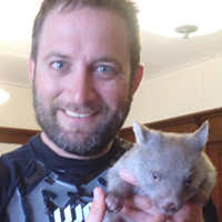
- The baby wombats – we met 3 babies being cared for by a lady in Whitemark. We were allowed to cuddle them. They were uber cute.
- The people on Flinders were so super friendly andaccomodating it was amazing. You definitely dont get anything like that in Sydney.
- The landscapes, especially on Clarke Island with standing tors of granite and massive boulders tinged with orange lichen.
Lowlights:
- Missing the family for the 19 days we were away
- The March flies. I’d say we’d swatted many dozens between us at each location.
- Not a biggybut on occasion the windwasannoying at camp when it blew sand everywhere. I’m thinking of Royden. Perhaps we should have moved to a more protected campsite.
- Although we saw so much, there were also bits and pieces we would have liked to have done and visited. The most glaring one was to have spent more time in the Kent Group and walking up to the lighthouse. Alas, the weather window was available and we needed to move on for the sake of the trip.
Warning: Photos in this trip report may distress some readers, especially if you are at work dreaming of kayaking. The report contains images of amazing landscapes, picturesque campsites, cute animals and good food.
All photos can be clicked on to enlarge.
____________________________________________________________________
Day 1: Sunday 8 January
Met up in Sydney’s north. Drove to Port Welshpool. Arrived around 10pm from what I can recall…I handed over the driving duties earlier and fell asleep.
I developed a sniffle on the drive down which I hoped was hay fever but it turned out that it was a cold. Luckily it was a minor cold and went again in a day or so.
____________________________________________________________________

GPS Track Day 2
Day 2: Monday 9 January
Port Welshpool to Johnny Suey Cove
Distance: 23km
Weather – Central Gippsland Coastal Waters – Forecast issued at 5:22 am EDT on Sunday 8 January 2012 – for Monday 9 January
Winds Westerly 20 to 30 knots.
Seas 2 to 3 metres.
1st Swell Southwesterly up to 3 metres tending westerly 0.5 to 2 metres from midday.
2nd Swell Northeasterly about 1 metre.
We spend the morning packing our gear which takes a long time for that first pack. Excess baggage was relegated to the car. We left around 11:30am after we were all ready.

Wind waves in the 20kt+ cross wind at Corner Inlet
The forecast was for strong winds and we could see a lot of whitecaps on the water but I rationalised that we’d be protected by the coastline as we headed south. We just had to reach there first. Wilsons Prom observations aren’t working but the Hogan obs that day were 38-40kts gusting 45-50kts. I think it was more like around 20kts in our location, gusting higher.
The trip through Corner Inlet gave us some pretty exciting wind waves on the beam.
We spotted other kayaks on the beach more or less right on the corner of Corner Inlet so we stopped for lunch and chat. They were a group from South Australia, exploring Wilsons Promontory for a later Bass Strait cross by one of them. From memory, there were two Malcolms, Donna, Margaret and Anna. I remember the Tahe Greenland T andtheRevalkayaks. I think it was Donna who said she was loving her Greenland T kayak.

Johnny Suey campsite
Johnny Suey is a lovely campsite and reminded me of some of the Nadgee sites I’ve been to. It was elevated and nestled amongst the trees right at the southern end of the beach, not far from a small creek and a lagoon. I baked in my oven a garlic infused roast lamb, complete with boiled potatoes, carrots and snow peas with gravy. It was a good start to our team’s culinary delights that we were to enjoy throughout the expedition and the oven got its first tick of approval. Mardi took care of dessert with a raspberry cheesecake. Yum. We’d drawn a number randomly in the car the day earlier to determine our dinner roster order. I was number 3 so I had to swap with Gary who’d drawn number 1.
____________________________________________________________________

GPS Track Day 3
Day 3: Tuesday 10 January
Johnny Suey Cove to Refuge Cove
Distance: 24km
Weather – Central Gippsland Coastal Waters – Forecast issued at 4:50 pm EDT on Monday 9 January 2012 – Tuesday 10 January
Winds Westerly 20 to 30 knots.
Seas 2 to 3 metres.
Swell Westerly about 1.5 metres tending southwesterly 0.5 metres late in the evening.

Views north of Johnny Suey Cove
With a short day of paddling anticipated, we packed and enjoyed a walk up to the peak on the northern end of the beach that we’d been looking at the previous evening and in the morning. It offered some great views of our Johnny Suey Cove andRabbit Island to the south and Three Mile Beach to the north.
On the way, we lunched at the southern end of Five Mile Beach and stopped at Sealers Cove to explore the rangers hut andhavea bit of a look around.
There were a number of yachts moored in Refuge Cove and another group of kayakers camped in South Refuge so we opted for North Refuge Cove. North Refuge Cove has no facilities and has retained is untouched bush character. That was a positive rather than a negative for us.

Gary's dehydrated orange slice made a great stained glass window
After dinner, we walked across to the South Refuge Bay. South Refuge Bay has toilets, flat camp sites more or less marked out, better fresh water supplies off the creek and interpretive signs pointing out trail heads. There was also an area with carved signs of the names of the various yachts that must have been moored in the bay for some days due to weather (long enough to carve a sign). These signs were mounted alongside a number of large whale bones. We could make out jaw bones and ribs.
We wandered over to the Queensland kayak group and introduced ourselves. Gary knew a bit about them as he had done his online research. They were a group of 4 men, Sam, Craig, Brent, Adam, and one lady, Kylie, doing the same trip as us, north to south and raising money and awareness for their charity. They were a younger team than ours – ages ranging 23 to 36 years old. Craig had his birthday on Hogan. We were to cross paths a total of five times during our trip – Refuge, Hogan, Deal, Royden andStrezlecki although we never saw each other actually on the water.
____________________________________________________________________
Day 4: Wednesday 11 January
Rest Day
Weather – Central Gippsland Coastal Waters – Forecast issued at 4:50 pm EDT on Tuesday 10 January 2012 – Wednesday 11 January
Winds Westerly 20 to 30 knots tending west to southwesterly 30 to 40 knots around dawn then becoming southwesterly 20 to 30 knots later in the evening.
Seas 2 to 3 metres increasing to 3 to 4 metres around dawn.
Swell Southwesterly about 1 metre.
Weather The chance of thunderstorms until evening with possible hail.

Here we are at Sealers Cove
I woke first and left camp to climb Kersops Peak before breakfast. I was only going to walk a short way but my HTC mobile handset couldn’t get network access so I kept climbing higher. It wasn’t until later that I discovered that my HTC has a hopeless antenna whereas my Blackberry worked just fine. Make sure you go to the Telstra website and look for the blue tick symbol indicatingahandset with a good antenna for rural use. Mobile telephone reception aside, wind and rain too, it was a pleasant walk.

Richard's dinner - bangers and mash
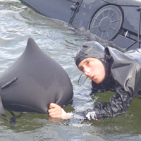
After I returned, the others were slowly emerging from their tents and we all walked to Sealers Cove for lunch, around 15km return. I remember being on an elevated rocky outcrop on the walk and we were looking down into the ocean far below watching a pod of dolphins.
____________________________________________________________________

GPS Track Day 5
Day 5: Thursday 12 January
Refuge Cove to Hogan Island
Distance: 55km
Weather – Central Gippsland Coastal Waters – Forecast issued at 4:51 pm EDT on Wednesday 11 January 2012 – Thursday 12 January
Winds Southwesterly 20 to 30 knots.
Seas 2 to 3 metres.
Swell Southwesterly 0.5 metres.
Actual Observations from Hogan Island
| Wind | Rain since 9am mm |
||||
| Date/Time EDT |
Temp °C |
Dir | Spd kts |
Gust kts |
|
| 12/05:30pm | 17.4 | W | 32 | 39 | 0 |
| 12/05:00pm | 17.7 | W | 30 | 35 | 0 |
| 12/04:30pm | 17.2 | W | 32 | 37 | 0 |
| 12/04:00pm | 18.1 | W | 30 | 34 | 0 |
| 12/03:30pm | 17.5 | W | 30 | 35 | 0 |
| 12/03:00pm | 18.3 | W | 30 | 35 | 0 |
| 12/02:30pm | 17.8 | WSW | 28 | 34 | 0 |
| 12/02:00pm | 16.7 | W | 30 | 34 | 0 |
| 12/01:30pm | 16.6 | W | 27 | 31 | 0 |
| 12/01:00pm | 16.6 | W | 24 | 29 | 0 |
| 12/12:30pm | 17.3 | W | 27 | 32 | 0 |
| 12/12:00pm | 17.6 | W | 26 | 29 | 0 |
| 12/11:30am | 16.9 | W | 25 | 29 | 0 |
| 12/11:00am | 15.9 | WSW | 27 | 32 | 0 |
| 12/10:30am | 16.0 | W | 21 | 29 | 0 |
| 12/10:00am | 16.5 | WSW | 24 | 27 | 0 |
| 12/09:30am | 16.1 | WSW | 24 | 29 | 0 |
| 12/09:00am | 14.5 | WSW | 26 | 30 | 2.2 |
| 12/08:30am | 14.1 | WSW | 25 | 30 | 2.2 |
| 12/08:00am | 14.8 | WSW | 25 | 29 | 2.2 |
| 12/07:30am | 13.9 | WSW | 28 | 33 | 2.2 |
| 12/07:00am | 13.3 | SW | 26 | 31 | 2.2 |

Stop horsing around. Look what beachcombing at North Refuge Cove revealed
The crossing to Hogan was the one and only moment on the trip with a capsize. We needed to really pitch in to help each other. No problem, that is why we paddle in groups…for exactly this type of thing.
From 2:00pm on, the wind increased to 30kts, gusting higher. It is my recollection that the weather forecast we’d checked the earlier evening wasn’t this strong but, from the blog of the Queensland kayakers, it seems that the forecast may have been upgraded that morning. At around 2:15pm, Mardi capsized and wet exited. Again at around 3:30pm. The wind generated waves were getting big. Kayaking websites describe these wind conditions capable of generating 13-20ft waves that heap up. I wouldn’t argue. These big waves made the earlier 20kt driven whitecaps mere playthings. The 30kt winds generated seas that piled on the crashing water down the wave faces and we had to wear it if we were in its path. I also wouldn’t argue with the note that paddlers should be off the water unless you’re very experienced. It certainly pushed our group away from our preferred relaxed paddling mode. With multiple capsizes, these were weather conditions I’d assumed we’d be sitting out on our expedition.

Penguins on Hogan
Mardi’s brand new battery turned out to be one of the occasional lemons one gets as it wouldn’t hold a charge. Mardi didn’t have her own hand pump and, even when given one by Richard, pumping with a skirt on was the only way to prevent the seas from spilling back in. Pumping in that way is awkward andslower. Our club should probably practise it so people are familiar with it. To add to our worries, we were drifting across the face of Hogan Island which, if not arrested, would have seen us drifting out to sea. I towed Mardi with Richard assisting her balance while Mardi pumped away to empty her cockpit of water. It took 5 minutes to get on top of things andwepaddled into Hogan Island’s lee. It was welcoming flat water that we were all grateful to have that crossing behind us.
| Beaufort Force Scale |
Original Beaufort Scale: Wind (Knots) |
Nautical Terminology | Appearance On Water |
Notes |
| 7 | 28-33 | Near Gale | Sea heaps up, waves 13-20 ft, white foam streaks off breakers | Paddlers should be off the water. |
It wont take a genius to figure out why we rested the next day. Another 30kt wind forecast didn’t fill us with the desire to do another crossing and risk further capsizes in big seas.
____________________________________________________________________
Day 6: Friday 13 January
Rest Day
Weather – Central Gippsland Coastal Waters – Forecast issued at 4:50 pm EDT on Thursday 12 January 2012 – Friday 13 January
Winds Southwesterly 20 to 30 knots decreasing to 20 to 25 knots early in the morning.
Seas 2 to 3 metres.
Swell Southwesterly 0.5 metres.

Hogan Island's hut
We camped at the stockyard end of the bay, perhaps 1km from the old hut end of the bay. On our rest day, we ambled across the rocks to the hut from an inspection and another chance to chat to the Queensland group who’d arrived into Hogan an hour or so after we did the day prior.
On the way to the hut, the impact of the grass fires was immediately obvious as lots of dead penguins lined the rocks just below the grassy slopes. It seemed to me that they’d died of smoke or heat more than simply being burned as their little bodies were intact. To see so many of the little creatures strewn here and there and in groups was quite sad.

Hogan Island's scarred hillside after the fires
The hut is nothing special but would offer some refuge if you were totally knackered and couldn’t be bothered putting up a tent. All reports were that the tank water is not to be used for drinking, including a handwritten sign in the hut. There were a few other water options including water we’d carried with us from Refuge Cove so it wasn’t a big deal for us.
Chatting to the Queenslanders was interesting as they recounted having a number of capsizes under sail of a few of their group. It put our prior day’s issue in perspective but still not one I was keen to repeat.

I'm taking a scenic seaside wash (ladies, avert your eyes)
Richard, MardiandGarywent for the circumnavigation of the island by foot along the rocky foreshore. I opted for a true rest and walked back to camp, having a fresh water wash along the way.

Rasberry muffins after a day's walk anyone?
The gang of three were stunned to return in the late afternoon to a treat of raspberrymuffinsthat I’d baked that afternoon. The oven got a second tick of approval.
____________________________________________________________________

GPS Track Day 7
Day 7: Saturday 14 January
Hogan IslandtoWinter Cove, Deal Island
Distance: 50km
Weather – Central Gippsland Coastal Waters – Forecast issued at 4:50 pm EDT on Friday 13 January 2012 – Saturday 14 January
Winds Southwesterly 15 to 20 knots decreasing to 10 to 15 knots by early evening.
Seas 1 to 2 metres.
1st Swell Southeasterly 0.5 metres.
2nd Swell Easterly 0.5 metres.

Looking down on Winter Cove
This was a fairly happy crossing for us although a bit of a slog towards the end. Once we ‘hit’ the island group, we dawdled our way around to Winter Cove. The sun was out and life seemed fine.
I think we were all fairly well paddled-out by the time we reached Winter Cove. The Queenslanderkayakteam were scattered all over the beach having left Hogan Island hours earlier than us. The closer we got to shore, the more obvious the surf became. It wasn’t huge, maybe 0.5m, but it wasn’t going to be as simple as gently sliding onto a sandy shore in enclosed waters. We were aiming for the left hand side which is where the campsites were but that was also where the rocks were. I mention this because this became an important thing a bit later. Gary and I happily landed and stretched our legs for the first time in 10 hours. STOP. A bigger wave, maybe 1m, breaking further out than the norm, just went under Mardi, almost snaring her in its grip. I went to the water’s edge and called for Mardi to back up until the set passed but it didn’t matter. The next wave got her, she broached, capsized and wet-exited. Her kayak was headed straighttothe rocks, like a magnet. Her gear was floating around like flotsam, hat, map, lunch box. My legs thankfully had enough energy left to carry me into the water to her kayak and together Mardi and I were able to turn the boat away from the waves, push it away from the rocks and guide it to shore. An exciting finish to the day’s paddling.

Caretaker's cottages, Deal Island
After setting up camp, Mardi and I hiked to the Caretakers Cottage, some 4km away up the hill via a creek, grassy slopes and plenty of wallabies that had come out for the dusk feed. We aimed for water andaweather update as well as to have a look around. We didn’t have long as we’d promised to get back quickly for dinner with the potential of doing a back-to-back crossing and heading for Killiecrankie the next day.
The caretakers, David and Mary, were very friendly and plied Mardi with fruit cake and tea and I took a wash at the water tank. We took 20L to take back to camp and I think I may have used another couple of litres in my wash. I wasn’t concerned, caretaker David pointed out that their supply was at 88,000L. David pointed out that Telstra reception was best at the water tank on the hillside that we’d approached on.
MardiandIhiked back in the failing light, arriving around 10pm. We ate dinner, Richard’s superbly crafted steak and kidney pie with pastry, and agreed we’d rise at 4am for a 6am departure for Killie. I think I hit the mattress approaching midnight that night but back to back crossings, taking advantage of good weather, and being a little bit buggered, is what a Bass Strait crossing is all about. Partly anyway.
____________________________________________________________________

GPS Track Day 8
Day 8: Sunday 15 January
Winter Cove, Deal Island to Killiecrankie
Distance: 66km
Weather – Central Gippsland Coastal Waters – Forecast issued at 4:50 pm EDT on Saturday 14 January 2012 – Sunday 15 January
Winds Northwest to southwesterly 5 to 15 knots tending northeasterly during the morning then tending east to northeasterly 15 to 20 knots by early evening. Afternoon inshore coastal seabreezes around 15 knots.
Seas Below 1 metre increasing to 1 to 2 metres later in the evening.
1st Swell Southerly 0.5 metres.
2nd Swell Easterly 0.5 metres.

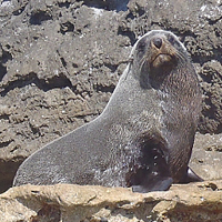
Wright Rock. You can see the hundreds of seals dotted on the rock
A fairly unremarkable start to the day. It was really early. Whilst packing and eating my usual porridge breakfast, followed by two minute noodles for extra calories for the long crossing, I’d watched the sunrise. The Sydney triple we’d met (Rob Parker and friends) had left, presumably at their planned time of midnight. They had lost time due to weather and had to cobble plans together to fly home out of Flinders Island.
The surf was still around but I think I was the only one in our gang that managed to cop an early salty wash. We struck out on what was to be the longest crossing and day of the trip. I felt some nervousness. Fatigue from the day before. Gary had a bad head cold. It turned out to be a great day and the right decision to paddle.

Seal at Wright Rock
The 60km trip was neatly broken into thirds by Wright Rock andCraggy Island at the 20km and40km marks. We had a glorious time paddling to Wright Rock. Spirits were high and the sea was flat. We were so relaxed we performed some practise eskimorolls around 10km offshore, halfway to Wright Rock.
Wright Rock was one of the highlights of the entire expedition for me. It was covered in hundreds of seals. Many more were in the water. The place was alive, well and truly. Barking noises, seals playing in the waves on the reef at the back of the island, lots of movement. I paddled a couple of laps of the island. It was a great place to visit and spend some time.
We left Wright Rock andpluggedaway for the next 20km to Craggy Island. However, due to tide, it slowly drifted out of the way so our planned visit was amended and we turned away from Craggy towards Killiecrankie. Only 20km to go.

Mardi approaches Killiecrankie
We reached Killiecrankie at around 6pm. We were all a bit stuffed. Guess what, it was my turn to cook the team dinner – shepherds pie for main meal and apple and cinnamon muffins for dessert.
We camped at Mary Ann andJude’s campground behind the dunes at KilliecrankieBay. They are lovely people but their campground is, well, pretty dodgy.

Marianne and Judy in Killiecrankie, owners of the campground
Why do we judge campsites that cost $5 per night and provide flat campsites, flush toilets and cold but fresh water showers when we’ve seen neither for a week? Even chairs. Ok, it was passable but, being behind the dunes, we missed the features we were getting used to enjoying…..water views, penguins. The facilities, whilst present, were run down. I later learned that their focus and love in life is their olive grove which they planted 10 years ago and have lovingly tendered ever since. Their first pressing of olive oil had occurred earlier in 2011 producing 400L of extra virgin oil.
____________________________________________________________________

GPS Track Day 9
Day 9: Monday 16 January
Killiecrankie to Royden Island
Distance: 15km
Weather – Central North Coastal Waters Forecast – Forecast issued at 4:06 pm EDT on Sunday 15 January 2012 – Monday 16 January
No wind warning for Monday for Central North Coast
Winds Northeasterly 15 to 20 knots.
Seas Below 1 metre increasing up to 1.5 metres later in the evening.
Swell Up to 0.5 metre.

Chillaxing at the Killiecrankie campsite
Day 9 marked the start of a different phase of the trip, namely along Flinders Island. The first phase was characterised by the remote islands and the crossings whereas Flinders Island, for me, was characterised by the friendly people we met.
Today we slept in on account of the two long days we’d just had. I woke before the others and went for a walk along the beach, explored around a little. I didn’t get that chance the night before as I was cooking. There was a nice park at the southern end of the beach with public toilets and picnic benches and I wonder whether camping was permitted. There didn’t seem any signs saying no.

Helen opened Killiecrankie's Deep Bite cafe for us on her day off. Ham and cheese toasted sandwich anyone
We wandered up to the cafe, called Deep Bite Cafe, which happened to be closed on Mondays. No dramas, Gary found a lady out the back, Helen, who was an employee living on site who was only too happy to open the cafe up for us. We all had ham and cheese toasted sandwiches and, if I recall correctly, Mardi may have had 3 icecreams. I think we all grabbed a couple of little items that took our fancy. I grabbed a Mars Bar and a coke. Helen was a nice lady who recounted how she, as a New Zealander, came to be at Ballarat and then took the job at the cafe at Killiecrankie, Flinders Island. It was an interesting series of events that lead to her being there. Food eaten, it was time to move on.
We headed to Royden Island, a relatively short paddle. Either I never knew or had forgotten being told but there is a lovely hut on the island, one of the best huts I’ve seen. It had a plastic water tank too, all of which was in good condition.

The luxurious Royden Hut with WA kayak team out the front
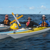
More remarkable was the fact that all three Bass Strait teams met up on Royden Island that night. The Queensland and WA teams had paddled from Winter Cove that day. There were 14 of us. It was a good feeling to be amongst other groups doing the same thing after having to explain to so many people over the last few months that what we were doing (ie paddling Bass Strait) wasn’t that uncommon any more. 14 of us. It was kind of Pitt Street.

The Sydney, Qld and WA teams all on Royden Island
Royden is another uninhabited island, more or less remote although it stands only a couple of kilometres off Flinders Island. We copped a strong wind through the afternoon and into the evening which picked up the fine white sand and blasted it into our faces, our hair, our tents, and our dinner. It was all through our tents. We retired to our tents fairly early that evening due to the wind and itredness and, although we all heard the cacophony of penguins in the early evening, no one was actually up and about to see one. Not me anyway.
Kayakers in photo (S)=Sydney team; (WA)=WA team; (Q)=Queensland team
Standing in back row left to right – Gary Roberts (S), David Fisher (S), Richard Barnes (S), Tim Johnson (WA – Blue jacket and lighter blue tshirt), Brent (Q), Kylie (Q), Adam (Q), Craig (Q), Jason Bresanello (WA – black jacket)
Kneeling in front row left to right – MardiBarnes, Matthew Coutts (WA – grey jumper), Ben Dallin (WA- blue jacket), Ross Lambert (WA – brown jumper)
____________________________________________________________________

GPS Track Day 10
Day 10: Tuesday 17 January
Royden Island to Whitemark
Distance: 42km
Weather – Central North Coastal Waters Forecast – Forecast issued at 4:09 pm EDT on Monday 16 January 2012 – Tuesday 17 January
No wind warning for Tuesday for Central North Coast
Winds North to northeasterly 15 to 20 knots becoming northerly 15 to 25 knots during the morning. Winds becoming northeasterly 10 to 15 knots during the afternoon.
Seas 1 to 1.5 metres increasing up to 2 metres around midday.
Swell Westerly 0.5 metres.

The team at Emita, Flinders Island
We split up a bit in the morning. Richard andMardi plied their way close to the coast. Gary and I cut across the bay and met them at Emita. Gary and I chatted to some local fellas that arrived for some fishing and abalone diving. Nice guys. we bumped into them again a couple of days later at Whitemark.

At the Furneaux Museum, Emita
When Richard andMardi arrived, we pulled our kayaks up high on the beach to avoid the flood tide and wandered off to the Furneaux Museum, located at Emita and maybe 5-10 minutes walk away. Patsy at the museum gave us the run down andwetook ourselves around. The highlights for me were the Nissen hut, full of ship wreck memorabilia and the Mutton room which detailed the mutton bird trade, ending with a barrel full of plucked and cleaned mutton birds in brine and bottles of mutton bird oil, useful to take some each day for all sorts of illnesses like rickets, malnutrition and wasting diseases…apparently.

Muttonbird Oil - prevents against ricketts
On our departure, Gary was chatting to Patsy about the nearby historical chapel. Patsy told us it was a few kilometres away and, to our amazement, simply offered us, a bunch of rough looking kayakers, her car to get there. We didn’t take up her kind offer as we had to get back to kayaks on the rising tide and get on our way. We didn’t want to miss last orders at the Interstate Hotel, Whitemark.

Whale bones at the museum
We continued to Whitemark, bashed into the headwind for the last 5km andlandedsouth of town on a grassy area complete with public toilets. The WA guys were there but no where to be found. At the pub we correctly surmised. By the time we arrived there, it was too late for a meal. Last orders were 1930. C’est la vie. I had a few beers andchattedto the locals. Gina was behind the bar, Pete Blythe was a chatty fellow and there was Cindy the mountain biker. And not to forget the dog playing pool andchasingthe white ball around.
____________________________________________________________________

GPS Track Day 11
Day 11: Wednesday 18 January
Whitemark to Fotheringate Bay
Distance: 12km
Weather – Central North Coastal Waters Forecast – Forecast issued at 4:06 pm EDT on Tuesday 17 January 2012 – Wednesday 18 January
No wind warning for Wednesday for Central North Coast
Winds Northeasterly 15 to 20 knots tending west to northwesterly 10 to 15 knots early in the morning then tending west to southwesterly 15 to 20 knots in the evening.
Seas Up to 1.5 metres.
1st Swell Up to 0.5 metres.
2nd Swell Northeasterly 0.5 metres.

Enjoying breakfast at Freckles Cafe, Whitemark
We agreed to be packed by 0900 for a one hour trip into town for supplies. Well one hour blew out to almost three. We settled into Freckles cafe for breakfast (think what a bacon and egg roll might be like after 11 days).
Wandering around town getting supplies from the bakery and supermarket, Mardi literally stumbled on baby wombats and so we all went to the general store to visit them.

The cutest wombat in the world. You cant buy that experience in Sydney
I think we ended up leaving shore around 1130. We bought a few supplies from the supermarket and bakery and headed off.
The tide was low and the first hour took us over some shallow waters sometimes scaping the hulls, walking and always scanning the waters for the next deep section.
We arrived at FotheringateBay just before2pm. The Bay is on the same jutting out headland as Trousers Point, only the north side. It is maybe a 20 minute walk between the two. We opted for this as we’d heard that 40 scouts had set up camp at Trousers Point and more or less taken over. This turned out to be true. They were there for 2 weeks, a Melbourne bunch (Balwyn I think) holidaying on Flinders.

Starting the Mt Strezlecki climb full of energy
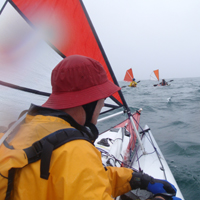
One of the funnier incidents of the trip happened as we were arriving. Gary had his kite up and hopped out in the shallows to take a photo of me as I was approaching. He let go of his kayak and the wind/kite took his kayak several hundred metres as Gary frantically chased it. The locals were enjoying a good laugh, as were we, watching the spectacle.
I met a lady named Joy Robinson who owned the shack up at the eastern endFortheringate Bay and she kindly offered showers and water, which we fully intended on taking up the offer but never did. Strezlecki got in the way.
We set up camp andheadedoff for the mountain after 3pm. It is around5km each way to the track head and around 7km return from there….up a 770m mountain. Even before we set out on the hike we could see that Strezlecki was capped in clouds but we went regardless. Sure enough, when we got to the top, it was still covered in clouds andthere was a fresh breeze blowing too. There were occasional moments when the clouds parted to reveal the amazing views. The moviebelowcaptures the noise of the wind and the streaming clouds across the face of the mountain very well.
____________________________________________________________________

GPS Track Day 12
Day 12: Thursday 19 January
Fotheringate Bay to Lady Barron
Distance: 29km
Weather – Banks Strait and Franklin Forecast – Forecast issued at 4:21 pm EDT on Wednesday 18 January 2012 – Thursday 19 January
No wind warning for Thursday for Banks Strait and Franklin Sound
Winds East to southeasterly 10 to 15 knots tending east to northeasterly around midday then tending north to northeasterly later in the evening.
Seas Below 1 metre.
Swell Easterly up to 1 metre.

Weathered rock at Fotheringate Bay
The forecast was accurate and we had headwinds through Franklin Sound so we had to bust our way to Lady Barron. The tides was against us too.
Tonight was pub night so there was to be no slacking off in case we missed last orders. The tavern also proved another opportunity for a beer, I mean to recharge our cameras and mobile phones. We also caught up with Pete Blythe, one of the fellas we met at Whitemark.
We camped just slightly to the west of town, in Gunters Bay. It was perfectly fine but we did see signposts indicating that Yellow Beach, just east of town was the place to camp. I cant vouch for what is there though as we never visited it.
At the tavern, Mardi networked and found out that showers were available and the lovely Robyn sorted us out. There was mention of a small fee but she waived it for us. We obviously looked filthy and in need of a shower. Or perhaps it was because we’d just had an expensive meal in the restaurant.
____________________________________________________________________
Day 13: Friday 20 January
Rest Day
Weather – Banks Strait and Franklin Forecast – Forecast issued at 4:14 pm EDT on Thursday 19 January 2012 – Friday 20 January
No wind warning for Friday for Banks Strait and Franklin Sound
Winds Northerly 5 to 10 knots tending northeasterly 10 to 15 knots in the morning then tending northwest to northeasterly 5 to 10 knots in the evening.
Seas Below 1 metre.
Swell East to northeasterly up to 1 metre.
I think this was the only rest day we had. We did have 2 no paddle days at Refuge and Hogan but this was the only day we chose not to paddle. Sort of. Richard andMardi went exploring by kayak and clocked up 30km.
Gary cleaned his kayak while I explored the town and went to the local Lady Barron store to meet Max, the proprietor. Max was a funny bloke and happy to chat. Max is an ex-fire fighter from Victoria who had come here to retire 4 years ago. Now he works 7 days a week manning his general store.
The store sold a lot more than groceries. It also sold petrol, was the local post office and sold a bunch of small hardware items and other stuff.
I bought some supplies and importantly a meat pie and drink to eat while I waited for Gary to turn up.
Gary and I started walking on the road out of town towards Whitemark, 26km away, and we were picked up by Rod. Rod and Lew separately offered us lifts as we hitched from Lady Barron to Whitemark. Rod took us part of the way before he had to turn off on another road. Lew took us the rest of the way. Interesting road trip stories of catching crays on the hooka. I think one only need ask for a ride on Flinders Is and it is available. Only one car went passed and didn’t stop for us but they were full of people.
Gary went to the doctor at the Flinders Hospital, Whitemark, to get his sores that weren’t healing looked at. I went to the pub, the local library, and checked out the local stores, again.
On our return, we were picked up by Barbara, a South African lady who came with her writer husband for some peace and quiet. Barbara was on her way to clean Max’s store as she had a cleaning business she’d set up. Barbara gave us tonnes of advice on catching, cleaning and cooking squid and even offered to come down to the Lady Barron wharf when we caught one to show us but we figured we’d manage.
So, did we go and try our hand at squidding? You betcha! Andguess who caught the biggest squid in all of Lady Barron that night? If you said me, you’d be 100% correct. There were 4 parties all trying their luck on the Lady Barron wharf. The lady near me had caught around 4 squid in 10 minutes. I moved a bit closer and, wham bam, I had the biggest squid on the line, spurting its inky blackness all over the place. The fella next to us couldn’t help himself and showed us how to clean the squid. Its funny how cleaning the squid involves making yourself filthy with the black ink spreading up your forearms. It wasn’t dissimilar to how Barbara had explained it. Now, armed with both the detailed explanation and having witnessed the demonstration, we were ready to go it alone.

Freshly baked bread at Lady Barron
Dinner was my turn again. I baked some loaves of bread, pumpkin soup, self saucing butterscotch pudding with custard and, after all of that, some squid.
____________________________________________________________________

GPS Track Day 14
Day 14: Saturday 21 January
Lady Barron to Cape Barren
Distance: 39km
Weather – Banks Strait and Franklin Forecast – Forecast issued at 4:13 pm EDT on Friday 20 January 2012 – Saturday 21 January
No wind warning for Saturday for Banks Strait and Franklin Sound
Winds Becoming southeasterly 15 to 20 knots.
Seas Below 1 metre increasing to 1 to 1.5 metres around midday then increasing to 1.5 to 2 metres during the afternoon.
Swell Up to 0.5 metre.

Gary and the Farsund shipwreck
The main objective was to visit the Farsundwreck, which went down on a sandbank on the north eastern tip of cape Barren Island almost 100 years ago to the day. We crossed the sound and edged along Vansittart Island and then crossed to the clearly visible wreck rusting away with a fair amount of it above the water.
We plugged along the coastline of Cape Barren against the tide until we reached a suitable and protected bay to camp in, some 5km short of Cape Barren village.
Excited by the prior evenings squidding effort, I decided to try my luck again at the current campsite. I walked maybe 30m away on some rocks just off the beach and cast my jig and hand line into the water in the dying minutes of the sun. Bang, bang. I scored 4 squid in a matter of minutes, to a lot of whooping and hollering I can tell you. We’re having squid tonight. Yeah!
____________________________________________________________________

GPS Track Day 15
Day 15: Sunday 22 January
Cape Barren to Preservation Island
Distance: 34km
Weather – Banks Strait and Franklin Forecast – Forecast issued at 4:07 pm EDT on Saturday 21 January 2012 – Sunday 22 January
No wind warning for Sunday for Banks Strait and Franklin Sound
Winds East to southeasterly 10 to 15 knots.
Seas 1 to 1.5 metres.
Swell Up to 0.5 metres.

Gary takes it easy on Cape Barren Island
I was really looking forward to visiting the Cape Barren village. Its hard to explain why but I’d had a lovely telephone conversation with a lady named Geraldine from the local aboriginal office when I asked for permission to camp a couple of months earlier. In the end, the entire village was closed on account of being a Sunday. I’d completely lost track of the days of the week.
There is a shop and some offices in the town centre, the local school was just up the road and there was some interesting maps of the walks andcampingareas on the island.

The granite boulders were simply amazing
With nothing open, we didn’t stay long. There was a moderate headwind as we plugged to Thunder and Lightning Bay for a lunch stop and we hugged the shoreline closely until we reached our designated point to leave Cape Barren and head for Preservation. There were wind vs tidal current waves on the crossing and I tried to catch some but they were in totally the opposite direction we needed to head in so I couldn’t pursue it much.

Orange lichen on granite boulder. Gary is in the front
I have to say I had a picture in my head that Preservation would be like a scene from the movie ‘Beach’ with Leonardo DiCaprio so I was a bit disappointed. We struggled to find a decently protected cove and, when we did, the access was blocked at low tide. we parked nearby and portaged gear to set camp and waited until the tide came in to shift the kayaks. In the end, I quite liked the camp site and that you could walk 100m and get views over both sides of the island as it is so narrow, maybe 200-300m across.
____________________________________________________________________

GPS Track Day 16
Day 16: Monday 23 January
Preservation Island to Clarke Island
Distance: 27km
Weather – Banks Strait and Franklin Forecast – Forecast issued at 4:06 pm EDT on Sunday 22 January 2012 – Monday 23 January
No wind warning for Monday for Banks Strait and Franklin Sound
Winds Northeasterly 10 to 15 knots.
Seas Below 1 metre increasing to 1 to 1.5 metres later in the evening.
Swell Up to 0.5 metres.
Through the trip, I think it is fair to say that Gary wasn’t the fastest at packing. I think Gary’s flu and the overall non-stop nature of the trip caught up with Gary and made him a slugabedtoday. It wasn’t out of laziness or anything like that, he just over-slept. He was totally surprised that he’d slept in for so long when he finally woke from his slumber. I could never sleep in like that on this trip as I always woke up relatively early. I kind of wish I had the ability to sleep in a bit longer. I was happy to have a chance to wander around. I thought about walking to the house and started but all options other than by kayak seemed too time consuming. Massive boulders blocked walking via the foreshore and there were no tracks via the shrubs and tussocks.

Massive bbq at the Preservation Island house
When we left, we decided to go via the house to grab some clean water even though it was a couple of kilometres out of the way. The house had plenty of water but to our tasting, the water was awfully contaminated with something. We took some just in case we needed it but we were all of a mind that we weren’t going to drink it unless absolutely necessary.
We crossed to Clarke fairly uneventfully; the crossing is only 4km. The granite tors and lichen covered boulders on Clarke were the best yet on the trip. The shapes and colours were very distinct and we were all wowed.
With the island’s remoteness and its natural beauty, I could see real merit in a more modest trip that left Mussleroe and plied north to, say to Trousers Point and Lady Barron, before heading back. This approach would certainly simplify the issue of getting a car from the start to the finish and removes the long crossings which pose risk and can chew up days if the weather doesn’t co-operate.

Clarke Island campsite perched on granite fingers sloping to the sea
We lunched in Spike Cove and decided to head a bit further south to shorten our final day’s paddle and crossing of the infamous Banks Strait. Again, we didn’t really find any suitable campsites for four tents and we knew the other side of Moriarty Point was be too exposed to the prevailing wind. We ended up opting for an amazing site perched up on sloping granite slabs, resting our kayaks on timber flotsam. All bar me pitched their tents using rocks instead of tent pegs and I pitched in a slight indent on the slope where some fine granite sand/silt had built up.
Knowing we’d land on mainland Tassie the next evening with a pub meal on offer, I opted to bring forward my cooking and shared the duty with Richard. With some left over goodies each, I cooked spagetti bolognaise two ways (one way was more or less traditional and the other was bolognaise meat sandwiched between large flat sheets of pasta…..lasagne sans bechamel sauce). On top and by pleading/begging request, I also knocked up a couple of loaves of fresh bread. Mmmmm. It was a late night and I was bulging at the seams by the time we’d finished eating.
____________________________________________________________________

GPS Track Day 17
Day 17: Tuesday 24 January
Clarke Island to Little Mussleroe Bay
Distance: 34km
Weather – Banks Strait and Franklin Forecast – Forecast issued at 4:07 pm EDT on Monday 23 January 2012 – Tuesday 24 January
No wind warning for Tuesday for Banks Strait and Franklin Sound
Winds North to northeasterly 10 to 20 knots decreasing to 5 to 15 knots early morning.
Seas Up to 1.5 metres.
Swell Easterly 0.5 metres.
Weather Patchy fog late in the evening with reduced visibility.

Richard backs into a gauntlet off Swan Island with the lighthouse in the background
Today we made it. We completed the jouney that we started out on. The plan that had been contemplated and, to an extent researched to death, the dream andmission was successfully completed. Andwe made Swan Island.
But not before one last touch of drama.
Our heading was such that it didn’t really counter the tidal flow sufficiently to reach Swan Island, our interim destination. It was nothing that more time and energy couldn’t solve and I was urging for the team to change tack and head straight for Mussleroe which would have been in a more tide friendly direction. I was outvoted. Again and again.
Although it was a bit of a slog, reaching Swan Island was great. At its eastern end and also offshore somewhat were raging tidal waves and the wind against them didnt help….or did depending on your view point. After the slog, I was in heaven. I felt rewarded by the flexing waters, heaving to and fro, crashing on the eastern reef. There were edges delineating the rough from the not so rough. I let myself slide on the reef to where the waves were steeper and turned to enjoy a downhill wave or two. We all had to tempt fate andcross the torrent. I guess we could have gone around. We didn’t. I remember clearly asking Mardi what she was thinking and she shouted back over the noise “I want to go the safest way”. I remember answering that it certainly wasn’t across the reef where a capsize would surely end up with a kayak splattered on the rocky shoreline maybe a hundred metres away. Before we could debate the merits and alternatives, Mardi blasted across the narrow section of the reef with superior confidence and determination and found herself across the worst (or best 🙂 ) of it and into deeper and calmer waters.
The southern side of Swan offered a lot of rocky gauntlets to cruise around in the bumpy water. We landed on a long white sand beach on the southern side for a well deserved lunch break.
After a swim and lunch (did i mention it was a super hot day), we walked over to the lighthouse for a brief look.
And then, before you know it, we landed at Mussleroe and we were done.
A great trip. Good company and plenty of memories.
____________________________________________________________________
Day 18: Wednesday 25 January
Boarded Spirit of Tasmania Ferry for overnight return to mainland Australia
____________________________________________________________________
Day 19: Thursday 26 January
Drove home from Melbourne


4 responses to “Bass Strait”